We remain fully operational. Our teams are working around the clock to ensure your deliveries continue safely.

DOWNLOAD THE APP


Customer Services
Copyright © 2025 Desertcart Holdings Limited
DOWNLOAD THE APP
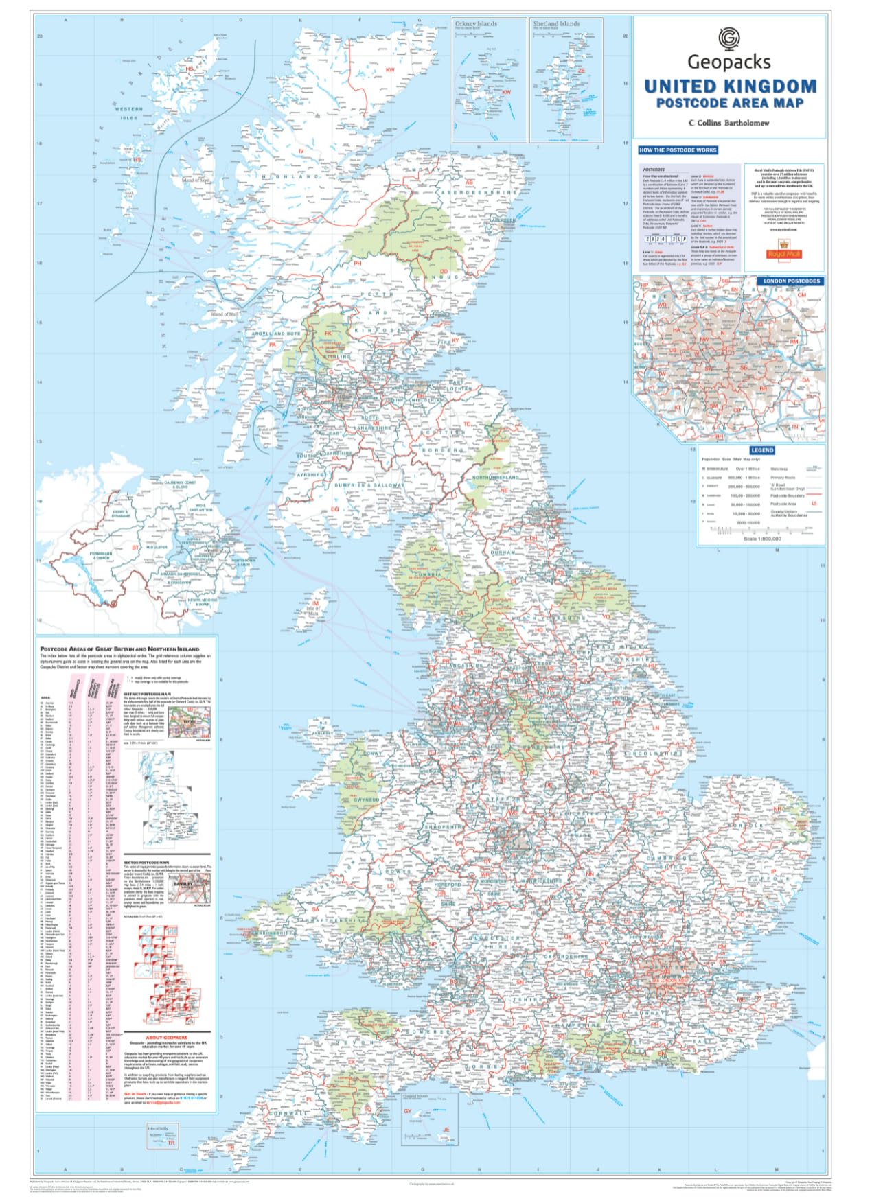

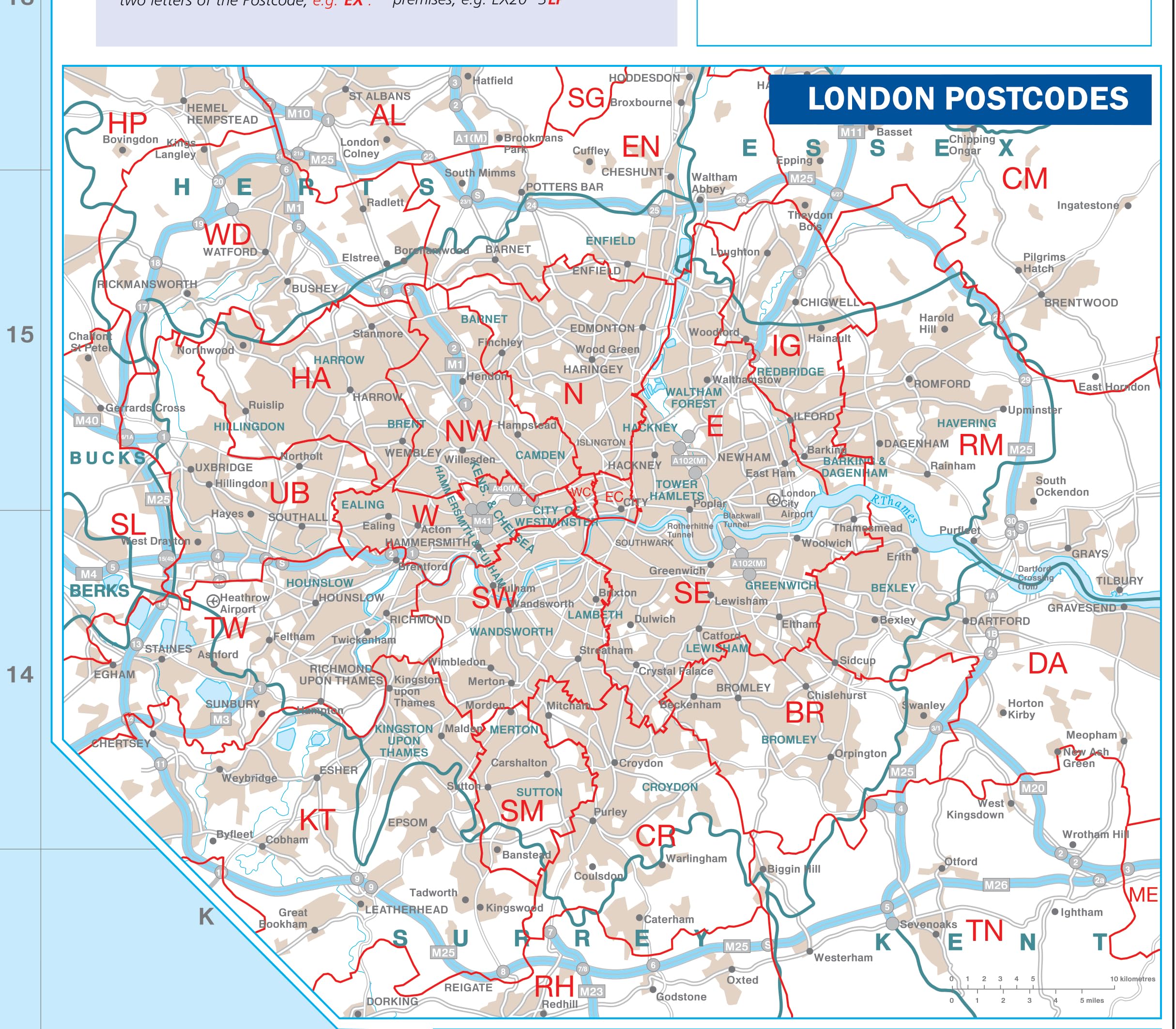
🗺️ Own the UK map that means business—plan smarter, lead sharper!
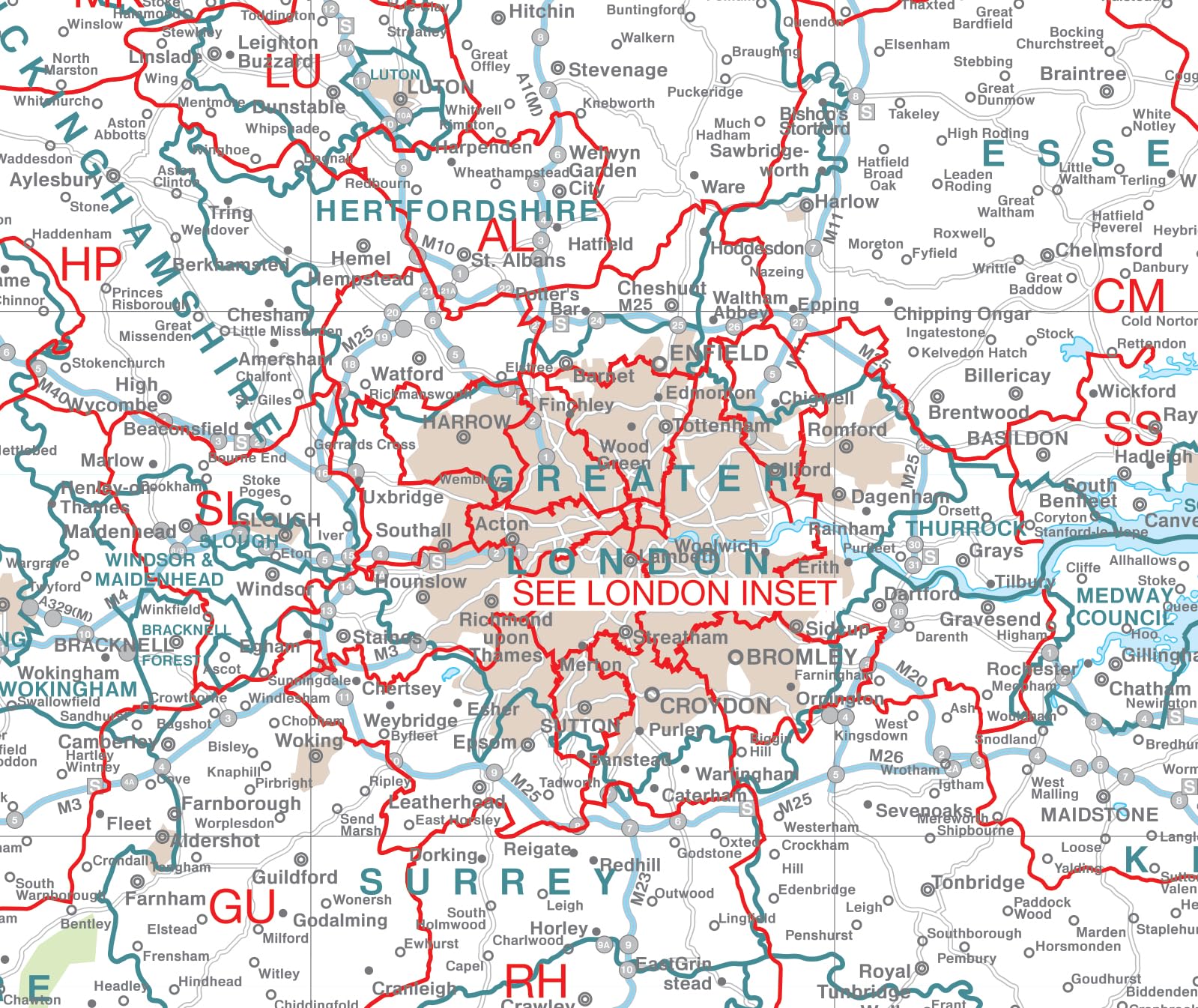
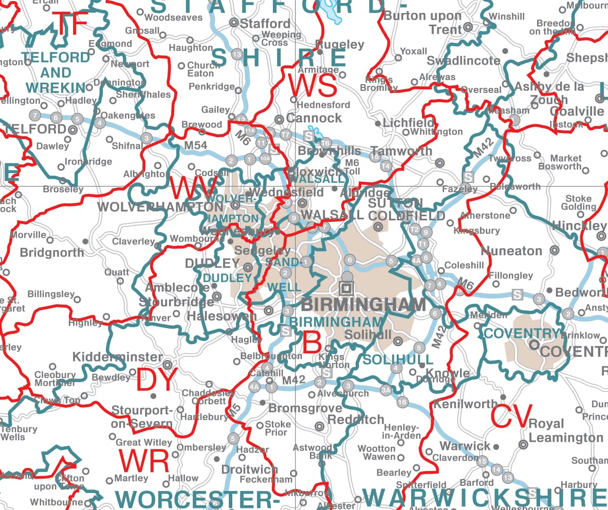
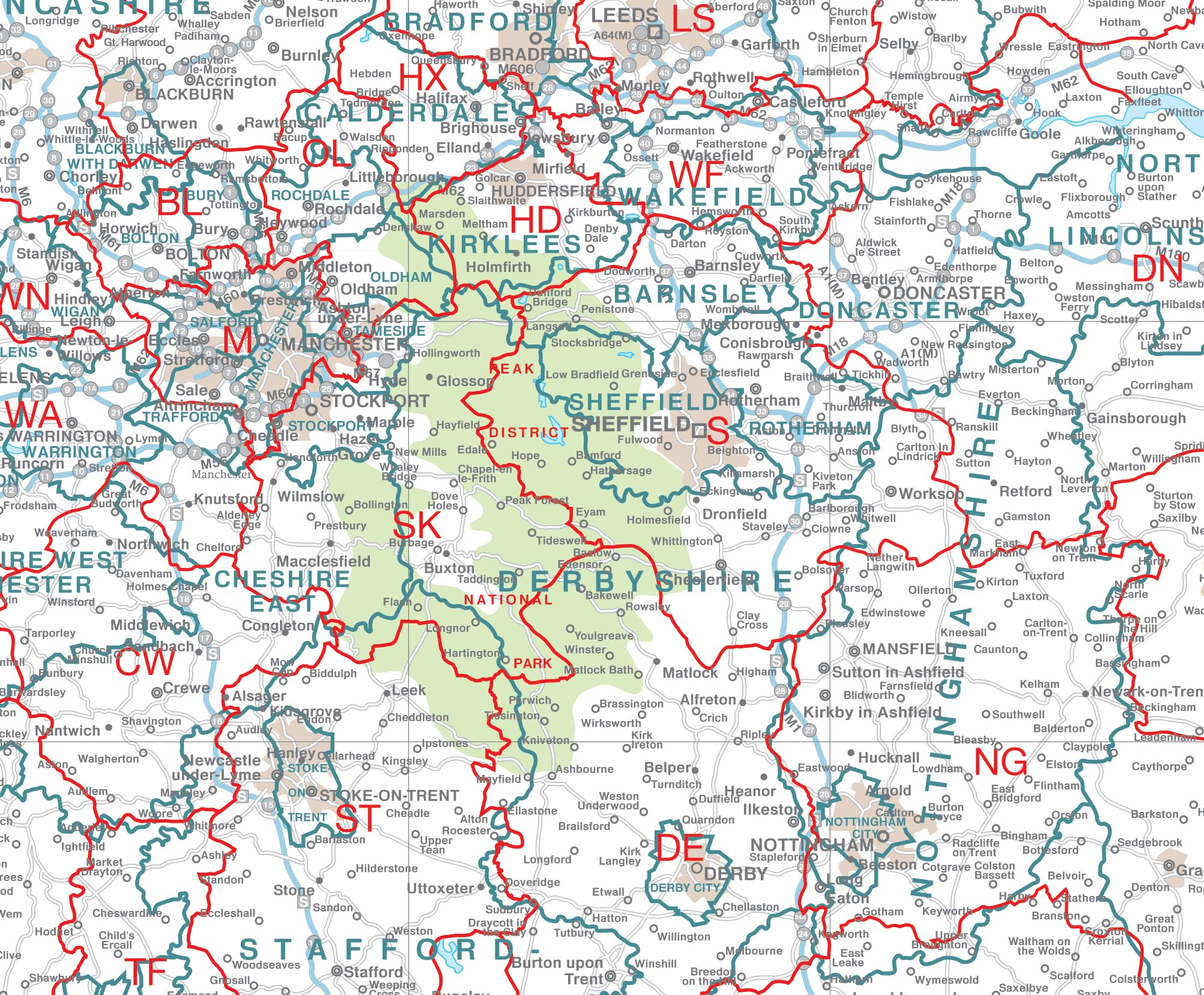
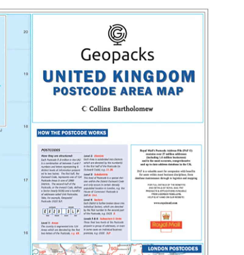
This large laminated UK postcode wall map (120cm x 83cm) offers comprehensive, up-to-date postcode, county, and district boundaries across England, Scotland, Wales, and Northern Ireland. Featuring detailed road networks and city markers, its durable writable surface is ideal for professionals needing precise geographic insights and flexible annotation. Updated annually, it’s a must-have for strategic business planning and property management.


| ASIN | B079T846LH |
| Best Sellers Rank | 107 in Educational Charts & Posters |
| Brand | Map Marketing |
| Colour | Laminated |
| Customer Reviews | 4.7 4.7 out of 5 stars (33) |
| Date First Available | 14 Feb. 2018 |
| Item Weight | 250 g |
| Manufacturer | Map Marketing |
| Manufacturer Part Number | BIPA-18 |
| Paper Finish | Glossy |
| Product Dimensions | 83 x 0.2 x 120 cm; 250 g |
| Sheet Size | 120cm x 83cm |
R**L
Size & Post Code details
Great Map. Quite large but had all the details I needed. As a project manager with a property portfolio the post code detail is brilliant.
G**S
Pleased with it
Takes an age for the rolled up status to relax enough to be pinned up good quality.
Trustpilot
2 weeks ago
3 weeks ago